Medieval Africa's Trading Empire
California Standard: 7.4 Students analyze the geographic, political, economic, religious, and social structures of the sub-Saharan civilizations of Ghana and Mali in Medieval Africa.
Student Version
Students will explore the geography, political, religious, and social stuctures of the civilizations living in and below the Sahara Desert
Students will look at the growth of Mali and Ghana through its geographic location and economic activities.
Students will look at the growth of Mali and Ghana through its geographic location and economic activities.
Lesson Plan
Paragraph.
Day 1:
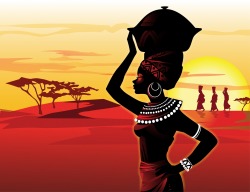
Warm-up: How does these pictures relate to Africa?
A. Geography Map (Color)
1. Color the vegetation zones of Africa according to the map on p. 135.
*Fill out the key.
2. Color the 3 African Kingdoms according to the map on p. 134
*Fill out the key.
3. Label: The Sahara Desert, Sahel, the Niger and Senegal Rivers, Nile River and Timbuktu
B. Answer Questions:
1. In which zone are people least likely to live in and why?
2. What vegetation zones are part of the three African kingdoms?
3. Why do you think the territory below the Sahara Desert might have had limited contact with lands to the north of the desert before the late 700s C.E.?
4. Why do you think the trading city of Timbuktu was located by the Niger River?
H.W. Vocab. 1 Draw and color
Day 2:
Warm-up: In which location, the savanna or the forest, do you think a city was more likely to develop? Give two reasons for your answer.
Folktale Sheet Directions: Read the folktale by yourself.
In your notebook:
A. Summarize: How would you summarize the whole story in one paragraph?
B. What are some interesting facts about the animal you are studying?
Using the project template form write in your final responses.
*Must be colored.
*Must be in blue or black pen.
*Color the map according to the region the animal is found. Choices: Desert, Sahel/Semidesert, *Forest, or Savanna
H.W. If not done, finish project
Paragraph.
Day 3:
Warm-up: Look at the picture on pg. 145 of your textbook and answer these questions about Ghana: a West African Trading Empire.
1. What is the man with the camel trading?
2. What is the man at the bottom trading?
3. Who do you think the man in the middle is and why is there bags by his throne?
Read Ch. 13.1 Introduction p. 145
Comprehension Check Questions:
1. What is Ghana?
2. How did Ghana become an empire?
3. What made the Ghana and its king rich?
Reading Notes Ch. 13
In partners, have class read textbook pgs. 146-149 and answer the questions on reading notes.
H.W. Finish the worksheet; make sure that Vocab. 1 and African Folktale project completed.
Day 4:
Warm up: Opinion: At least 2 reasons: Salt is worth more than gold.
Uses of salt worksheet
Ghana’s System of Taxes Gold-Salt Trade Ppt.
Read 13.5 p. 152 Paragraph 4, 5, and 6 (Key term: Silent Barter)
Gold/Salt Experiential
H.W. Trans-Saharan Trade Map
Back to
Day 5:
Warm-up: Look over Mali paragraph assessment paper and write down any questions you have about the paragraph you will write today.
Ghana Primary Source
Brainstorming: Start it together
Go over TS and CS’s…
HW: Finish final draft
Warm-up: Look over Mali paragraph assessment paper and write down any questions you have about the paragraph you will write today.
Ghana Primary Source
Brainstorming: Start it together
Go over TS and CS’s…
HW: Finish final draft
Day 6:
Warm-up: Although Ghana was a powerful empire, it fell in 1203 when a rival kingdom took over the capital of Ghana called Kumbi. Why do you think it fell?
Read 13.6 Decline of Ghana and Rise of Mali p. 153
Mali Summary Sheet
H.W. Complete Summary Sheet
Warm-up: Although Ghana was a powerful empire, it fell in 1203 when a rival kingdom took over the capital of Ghana called Kumbi. Why do you think it fell?
Read 13.6 Decline of Ghana and Rise of Mali p. 153
Mali Summary Sheet
H.W. Complete Summary Sheet
Day 7: Mali
Warm-up:
1.How many times is Mali bigger than Ghana?
2.What important river runs through Mali?
3.Name an important trading city.
Mali and GRAPES Game
Intro. to Mali
Compare and Contrast Mali and Ghana
Mansa Musa
Timbuktu Clip
H.W. Mansa Musa Postage Stamp
Warm-up:
1.How many times is Mali bigger than Ghana?
2.What important river runs through Mali?
3.Name an important trading city.
Mali and GRAPES Game
Intro. to Mali
Compare and Contrast Mali and Ghana
Mansa Musa
Timbuktu Clip
H.W. Mansa Musa Postage Stamp
Day 8:
Warm-up: Look at the map of the spread of Islam again.
What were three ways that Islam spread?
What are some countries Islam spread into?
Influence of Islam on West Africa Ppt.
Placard Activity
Reading Notes Ch. 14 104
H.W. Draw the picture inside the bubble.
Back to TOP
Warm-up: Look at the map of the spread of Islam again.
What were three ways that Islam spread?
What are some countries Islam spread into?
Influence of Islam on West Africa Ppt.
Placard Activity
Reading Notes Ch. 14 104
H.W. Draw the picture inside the bubble.
Back to TOP
Day 9:
Warm-up: Spread of Islamic Influence Placard 1:
In what ways do you see Islam influencing West Africa in this picture?
Introduce Map project for Google Earth
HW: Test Review Sheet
Warm-up: Spread of Islamic Influence Placard 1:
In what ways do you see Islam influencing West Africa in this picture?
Introduce Map project for Google Earth
HW: Test Review Sheet
Day 10: Test/Review
Day 11:Map project
H.W. Finish Map Project
H.W. Finish Map Project
